Cirque de Gavarnie: planning the walk to the great waterfall
Cirque de Gavarnie at a glance
- Admission
- Free
- Time needed
- about 2 h 30 min
- Where
- Gavarnie-Gèdre
Facts checked on 11 November 2026. Full opening hours, reduced prices and access
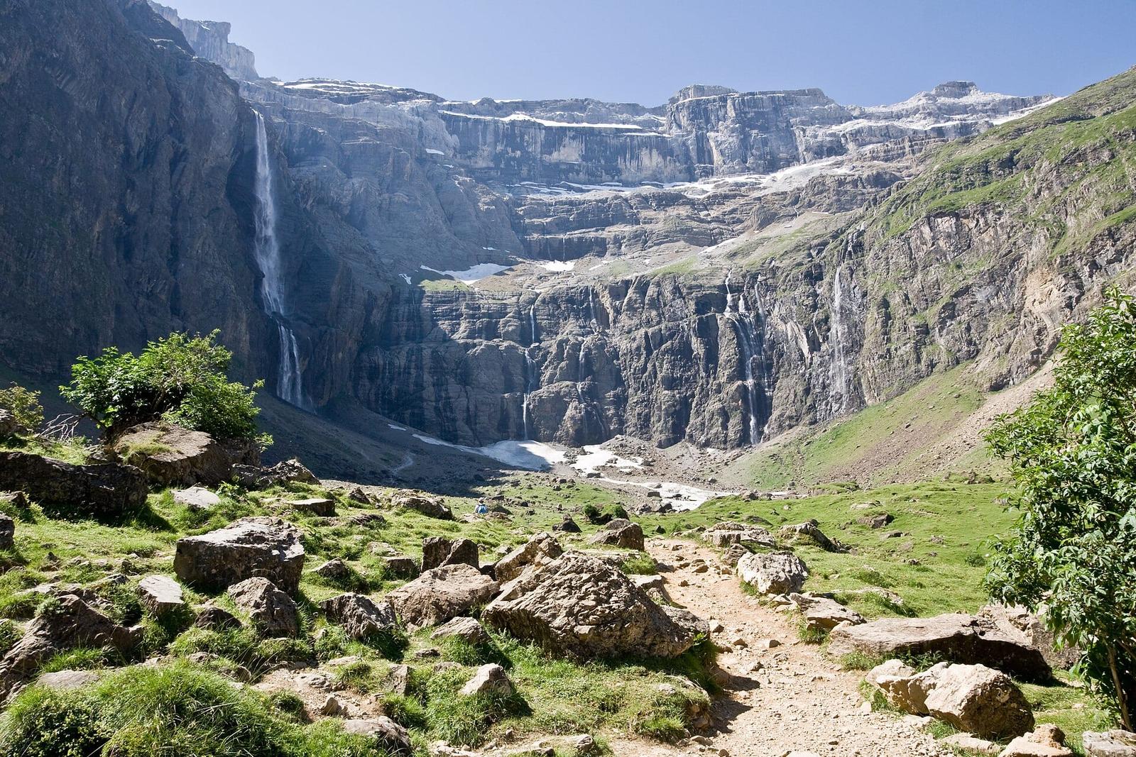

At the head of the valley, above the village of Gavarnie, a 1500 m limestone wall closes off the horizon in a half-circle. A 423 m waterfall pours down the middle. You reach the cirque on foot by a wide, easy path that suits families. Here is how long the walk takes, where to park, the best season, the national park rules and our tips for enjoying the site without the crowds.
Cirque de Gavarnie at a glance
- Where: at the head of the Gave de Pau valley, in the Hautes-Pyrénées, on the Spanish border. The trail starts in the village of Gavarnie, 20 km south of Luz-Saint-Sauveur.
- Price: access to the cirque is free. The public car parks at the entrance to the village charge from February to October.
- Open: a natural site with free access. The walk to the Hôtellerie du Cirque is usually possible from May to early November, and the walk to the foot of the great waterfall from June.
- Walking time: 2 h 30 return to the Hôtellerie du Cirque, plus about 1 hour 20 minutes to climb to the foot of the waterfall and back.
- Best for: everyone as far as the Hôtellerie, children included; the climb to the waterfall needs good shoes and some hiking experience.
- Good to know: the cirque is in the core zone of the Pyrenees National Park. Dogs are tolerated on a lead on the main path only.
Why is the Cirque de Gavarnie so famous?
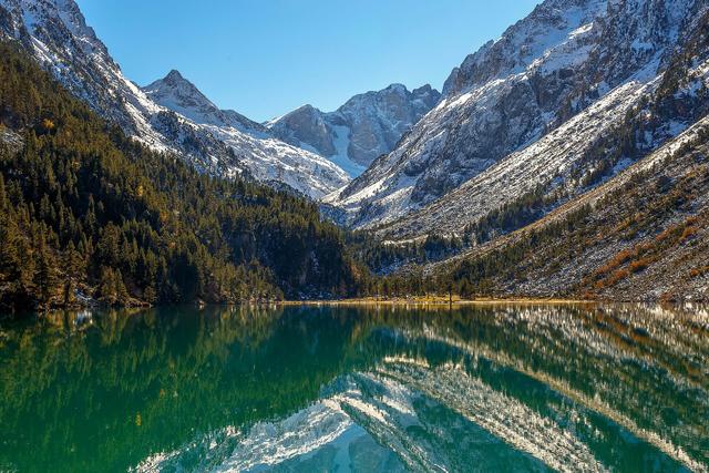
The cirque is a huge bowl carved out by glaciers. Its walls rise to almost 1500 m, in three tiers of cliffs separated by ledges that stay snowy for much of the year. At its base, the half-circle measures about 6.5 km round. Above it, the ridge carries several peaks over 3,000 m, including the Marboré, the highest point of the cirque at 3248 m. On the other side is Spain.
In the centre, the Grande Cascade drops in a single fall of 423 m. It is one of the highest waterfalls in Europe and the source of the Gave de Pau, which then flows through Lourdes and Pau. Depending on the source, it is given as 417 to 423 m: the height varies with the starting point chosen for the measurement.
In 1997, the cirque was added to the UNESCO World Heritage list, along with the nearby cirques of Estaubé and Troumouse, as part of the French-Spanish "Pyrénées-Mont Perdu" site. It combines natural landscapes with a pastoral culture that is still alive on both sides of the border. Monte Perdido (3355 m), on the Spanish side, gives it its name.
Victor Hugo's line. Victor Hugo came to the Pyrenees in 1843 and described Gavarnie in his long unfinished poem Dieu as "the Colosseum of nature". The phrase stuck, and you will see it quoted all over the village.
The Brèche de Roland. On the ridge, at 2807 m, a square notch cuts through the wall. According to legend, the knight Roland opened it with a blow of his sword Durandal as he tried to break it before he died. You can see it clearly from the path to the cirque, to the left of the waterfall as you face the end of the valley.
How much does it cost to visit the Cirque de Gavarnie?
Nothing: the cirque is a natural site, with no ticket and no gate. The only cost is parking. The tourist office says the public car parks at the entrance to the village charge from February to October. The rate is not published on its website, so bring a bank card or some change for the pay machine.
Park in these car parks rather than in the village, where space is short. In high summer they fill up early in the morning.
How long is the walk to the Cirque de Gavarnie?
The simplest route follows the main path from the village to the Hôtellerie du Cirque, at the foot of the cliffs. The tourist office figures:
- Distance: 7.9 km return.
- Time: 2 h 30 return, not counting breaks.
- Elevation gain: 226 m of climbing, from 1370 m in the village to 1570 m at the Hôtellerie.
- Difficulty: easy. The path is wide and mostly on a gentle slope.
With a picnic, photos and a break at the Hôtellerie, most visitors spend half a day there. With the climb to the foot of the waterfall, allow 2.5 to 4 hours of walking depending on your pace.
The route to the Hôtellerie du Cirque
You set off opposite the tourist office, along the village's main street. You pass the CRS mountain rescue post, then cross the river and follow a wide, flat track along the water.
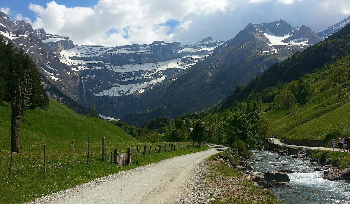

After the cattle pen, carry straight on and do not take the path that climbs towards the Espuguettes refuge. The path then passes near the Nadau bridge, without crossing it, and climbs to a first viewpoint over the cirque. A short stretch through a beech wood leads to the Courade plateau, then a last steep section brings you to the Hôtellerie du Cirque. You come back the same way.
The Hôtellerie du Cirque. This old building at the end of the path is a hotel with a bar and restaurant open during the day, usually from mid-May to the end of October. It is the classic viewpoint over the waterfall and the wall, and where the walk ends for many families.
Other routes. To avoid coming back the same way, the tourist office suggests a loop via the Bellevue plateau: 9.3 km, 450 m of climbing and about 3 h 30. The loop via the Corniche des Espugues, which is more exposed, takes about 4 h with 390 m of climbing; it gives a bird's-eye view over the whole cirque.
Can you walk to the foot of the Gavarnie waterfall?
Yes, but it is a different kind of walk. From the Hôtellerie, a path climbs the scree slope to the foot of the falls. Allow about 45 minutes up and 35 minutes down, with 200 m of extra climbing. The tourist office rates this section as difficult.
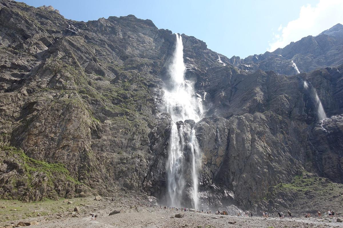

Three things to know before you go:
- The end of the climb is steep and rocky. Proper walking boots are essential.
- Rockfall is common at the foot of the waterfall. Do not linger under the cliffs.
- In spring, snow bridges cover the stream. They can give way without warning. Going to the waterfall is strongly discouraged in winter and spring because of avalanches. Wait until June, or even mid-June, and ask the tourist office about the state of the path.
Our tip: the waterfall is at its most spectacular in late spring and early summer, when the snow melts. In late summer and autumn, its flow drops sharply.
On horseback or by donkey
The main path has long been used on foot, on horseback or by mule. Operators in the village offer rides up to the Hôtellerie on horseback or by donkey during the season. It is an option for young children or for anyone who does not walk much. Prices and times vary from one operator to another, so ask locally or at the tourist office.
On the path, let the animals pass and do not stand behind them.
When to visit the Cirque de Gavarnie
From June to September, the whole route is normally passable, and it is the best time for the waterfall. It is also the busiest season: the tourist office points out that the path is very crowded in summer and advises setting off early in the morning.
In May and October, the path to the Hôtellerie is often open and the car parks are quieter, but snow may still, or already, cover the upper cirque. The autumn colours in the beech wood are worth the trip.
From November to April, the cirque looks very different. The path to the Hôtellerie is not recommended in winter and going to the waterfall is discouraged. The tourist office suggests snowshoe routes, and the Gavarnie-Gèdre ski resort is open. Check the avalanche risk before you set off.
What time? If you leave before 9 am in summer, you will find a parking space and walk in the cool. Mountain thunderstorms are common in the afternoon in July and August, so check the forecast the day before.
Visiting the Cirque de Gavarnie with children
The path to the Hôtellerie is one of the great family walks in the Pyrenees. Children used to walking manage it easily, with plenty of picnic spots along the river.
- Pushchair: possible on the first, flat section along the river. Higher up, the climb through the wood and the last steep stretch are easier with a baby carrier.
- Donkeys and horses: a good way to motivate younger children for the climb.
- What to bring: even in summer, pack a warm layer and a windproof jacket. At the foot of the cliffs it is much cooler than in the village.
- The waterfall: with young children, stop at the Hôtellerie. The climb to the foot of the waterfall is steep and exposed to rockfall.
Dogs and national park rules
The cirque is in the core zone of the Pyrenees National Park, marked by signs with a red izard (Pyrenean chamois) head. The rules are strict:
- Dogs: tolerated on a lead on the main path, from the village to the Hôtellerie. They are banned on the other trails and between the Hôtellerie and the waterfall.
- Banned: fires, bikes and hunting.
- Please: stay on the paths, take all your rubbish home, including picnic leftovers, and do not build cairns.
The national park has a visitor centre in Gavarnie, on +33 5 62 92 42 48. You will find information there on wildlife, plants and trails.
Wheelchair access
The cirque is not accessible to visitors with reduced mobility. According to the tourist office, only the first 300 metres of the path are flat and may suit a wheelchair.
How to get to the Cirque de Gavarnie
By car. Drive up the Gave de Pau valley on the D 921, via Argelès-Gazost, Luz-Saint-Sauveur and Gèdre. Gavarnie is a dead end: the road stops at the village. Allow about an hour from Lourdes, more in summer because of traffic in the valley.
By bus. The nearest railway station is Lourdes. From June to September, bus line 968 links Lourdes, Pierrefitte-Nestalas and Gavarnie. Get off at "Gavarnie - Office de Tourisme", a few minutes from the start of the trail. The rest of the year, getting there without a car is difficult.
On a day trip. Several agencies offer day trips from Lourdes, with coach transport and free time at the cirque.
Partner links: if you book through these links, we earn a commission at no extra cost to you. Partner links · Learn more
Renting a car. Pau airport and Tarbes-Lourdes airport both give easy access to the valley and let you combine Gavarnie with other sites in the Hautes-Pyrénées.
What to visit near the Cirque de Gavarnie
| Also worth seeing | Distance | Travel time |
|---|---|---|
| Parc animalier des Pyrénées | 37 km | 45 min by car |
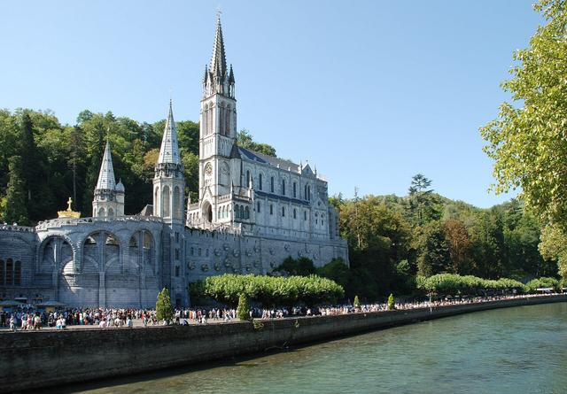
| Sanctuary of Our Lady of Lourdes | 50 km | 60 min by car |
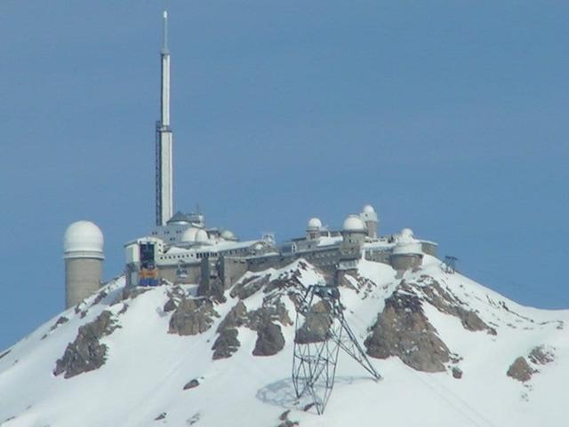
| Pic du Midi de Bigorre | 45 km | 70 min by car |
Approximate road distances and travel times.
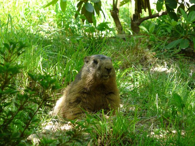
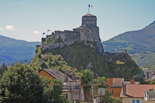
On the way back down the valley, the Parc Animalier des Pyrénées in Argelès-Gazost has bears, wolves and marmots: a good stop with children. See also: Parc animalier des Pyrénées Lourdes is an hour's drive away, with its sanctuaries and its fortified castle, home to the Pyrenean museum. See also: Sanctuary of Our Lady of Lourdes, Lourdes Castle (Château fort)
In summer, when the Col du Tourmalet is open, you can drive over to La Mongie and go up the Pic du Midi de Bigorre, another great Pyrenean viewpoint. See also: Pic du Midi de Bigorre, Bétharram Caves, Gouffre d'Esparros, Château de Pau, Basque Country and Pyrenees
Where to eat and stay in Gavarnie
The village of Gavarnie has hotels, restaurants, gîtes (self-catering houses) and a campsite. The Hôtellerie du Cirque, at the end of the path, serves food and drinks during the day in season. The path follows the river and has plenty of picnic spots: the simplest option with a family.
Staying in the village lets you hit the trail before the tour coaches arrive. Luz-Saint-Sauveur, twenty minutes away, has more choice, and Lourdes remains the main hotel base in the area.
Gavarnie village and the Pyrenean climbers
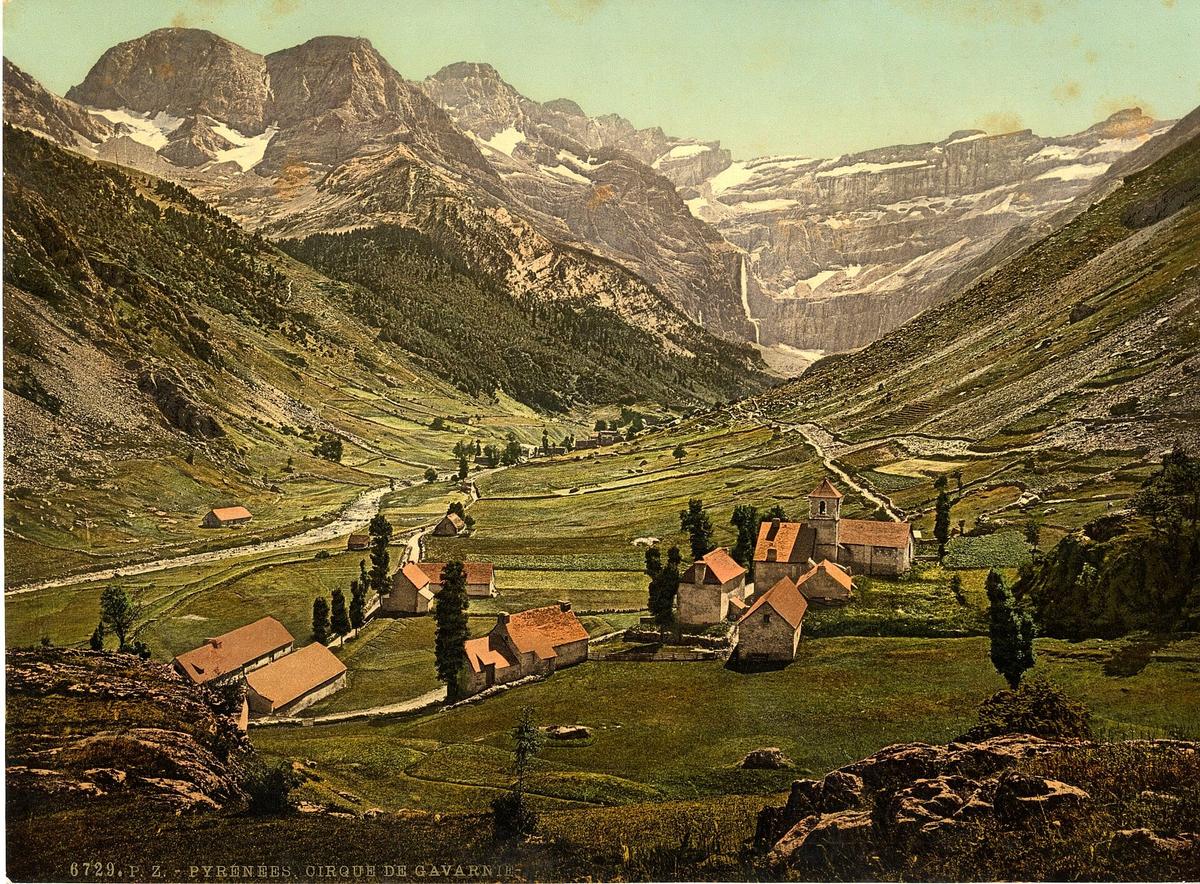
Gavarnie was long a shepherds' hamlet. It became a commune in 1842 and is now part of the commune of Gavarnie-Gèdre. In the 19th century it became the base for the pyrénéistes, the explorers who climbed and mapped the peaks of the range.

At the entrance to the village, a statue honours Count Henry Russell, a great Pyrenean climber, famous for the nights he spent in caves dug out on the Vignemale. In the small cemetery, several pioneers' graves recall this history. That of the geographer Franz Schrader, who drew the first accurate maps of the massif, lies away from the path to the cirque.
Every summer, the Gavarnie festival sets up an open-air theatre stage facing the mountains. It draws nearly 10,000 spectators over two weeks.
FAQ
Is there a charge to visit the Cirque de Gavarnie?
No, the site is free. Only the public car parks at the entrance to the village charge, from February to October.
How long does it take to walk to the Cirque de Gavarnie?
About 2 h 30 return from the village to the Hôtellerie du Cirque, for 7.9 km and 226 m of climbing. Add about 1 hour 20 minutes to go to the foot of the great waterfall and back.
Is the Cirque de Gavarnie hike difficult?
Not as far as the Hôtellerie: the path is wide and rated easy. The final climb to the waterfall is steep, rocky and exposed to rockfall.
Can I take my dog to the Cirque de Gavarnie?
Yes, on a lead, but only on the main path between the village and the Hôtellerie. Dogs are banned beyond it, towards the waterfall, and on the other trails of the national park.
When is the best time to see the Gavarnie waterfall?
June and July, when the snow melts, the flow is at its strongest and the path is clear. Before June, going to the foot of the waterfall is not recommended.
Can I get to Gavarnie without a car?
Yes, in summer: from June to September, bus line 968 links Lourdes station to the village.
Practical information
Official ticket-office prices 2026
Free admission
Address
Village de Gavarnie, 65120 Gavarnie-Gèdre, France
Directions · Phone+33 5 62 92 49 10
On site and nearby
- Nearest shops and pharmacy: Torla-Ordesa, 15 km away Straight-line distance, based on OpenStreetMap.
- Emergencies: 112 (all emergencies, free from any phone), 15 (SAMU, medical emergency)
Around the site, on Google Maps
With children
Family days out nearby: Lac de Gaube and Pont d'Espagne (17 km), Pic du Midi de Bigorre (26 km), Parc animalier des Pyrénées (32 km)
Swimming pools and play areas nearby, on Google Maps
Facts checked on 11 November 2026. Sources: valleesdegavarnie.com, geotrek65admin.openig.org, tourisme-occitanie.com, fr.wikipedia.org, cdt65.media.tourinsoft.eu
Map
In the same region
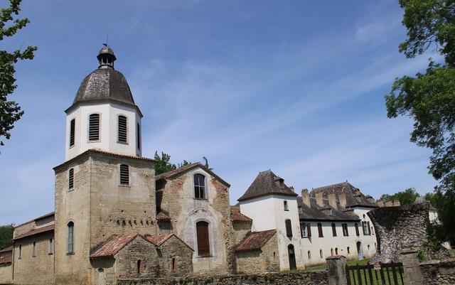
- Château de Morlannefrom €7Free under 7
- Gouffre d'Esparrosfrom €12.50Free under 4