Haut-Barr Castle: planning your visit
Haut-Barr Castle at a glance
- Admission
- Free
- Where
- Saverne
Facts checked on 12 November 2026. Full opening hours, reduced prices and access
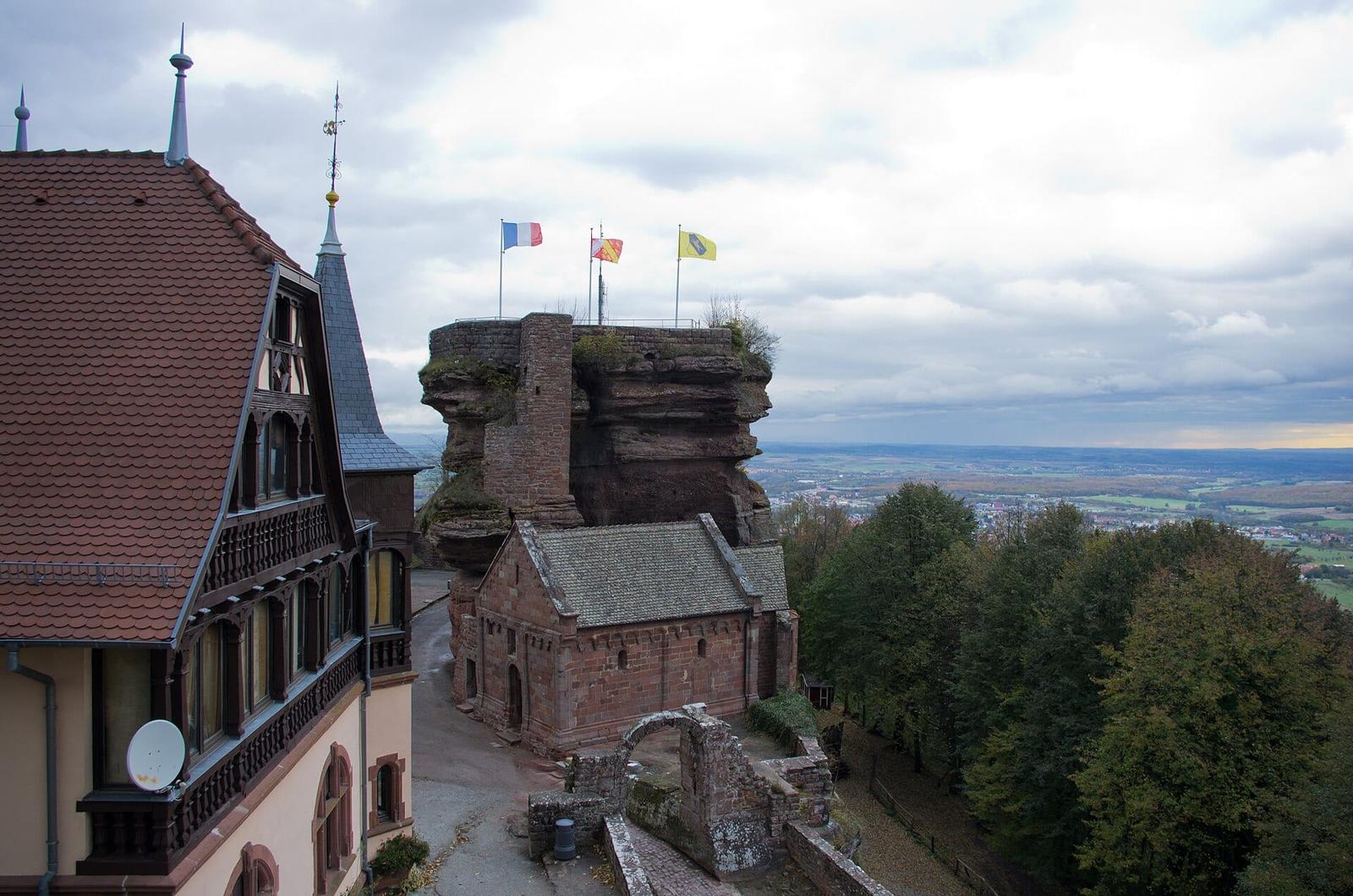

High above Saverne, the ruins of Haut-Barr cling to three pink sandstone rocks. You climb up by steps cut into the rock, cross the Devil's Bridge and, on a clear day, see the spire of Strasbourg Cathedral. The site is free and open all year. Here is how to get there, what to see and how to plan your visit.
Haut-Barr Castle at a glance
- Where: on a sandstone spur about 2.5 km south of Saverne (Bas-Rhin), at the edge of the Northern Vosges, at an altitude of about 470 metres.
- Price: free entry, all year round. There is no ticket office and no ticket.
- Getting there: five minutes by car from the centre of Saverne, or about an hour and a half on foot along waymarked trails.
- Time needed: an hour is enough for the ruins; allow half a day with the hike from town.
- Best for: castle lovers, walkers, families with children who are steady on their feet.
- Good to know: fragile ruins, steep steps and sheer drops. You visit at your own risk, and the site is not wheelchair accessible.

Why visit Haut-Barr Castle
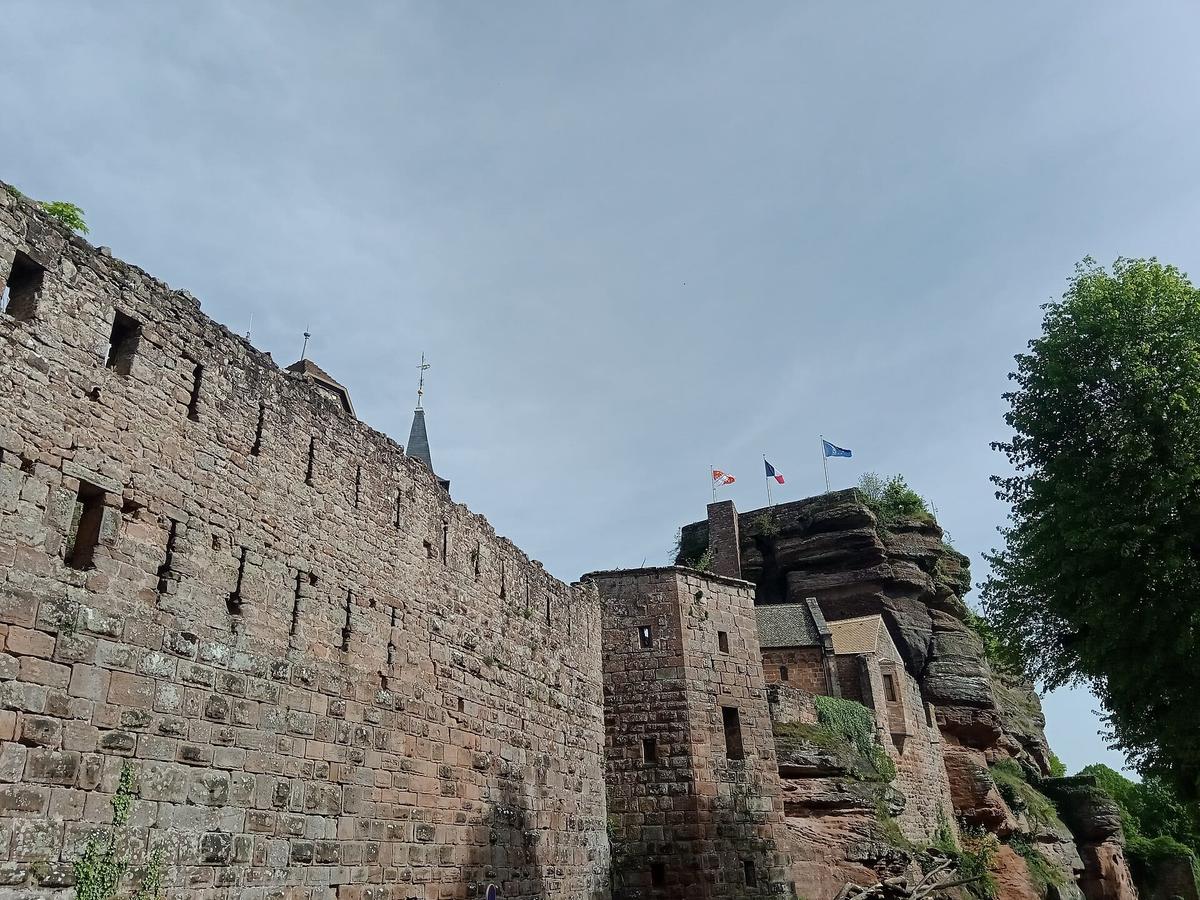
Haut-Barr has a nickname that says it all: "the Eye of Alsace". Perched on the edge of the Vosges, it overlooks the Zorn valley, with the Alsace plain on one side and the Lorraine plateau on the other. The bishops of Strasbourg held it for centuries to watch over the Saverne pass, the main route between Lorraine and Alsace.
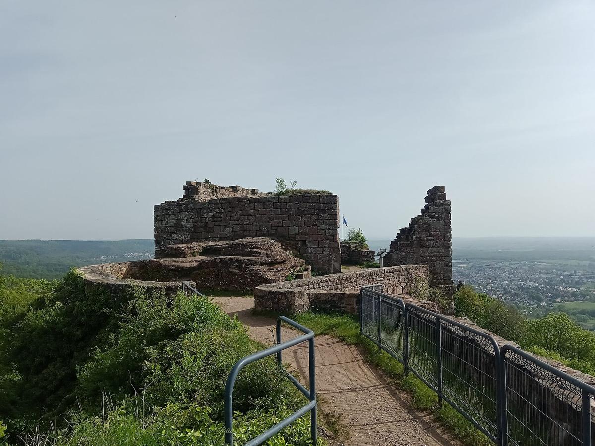

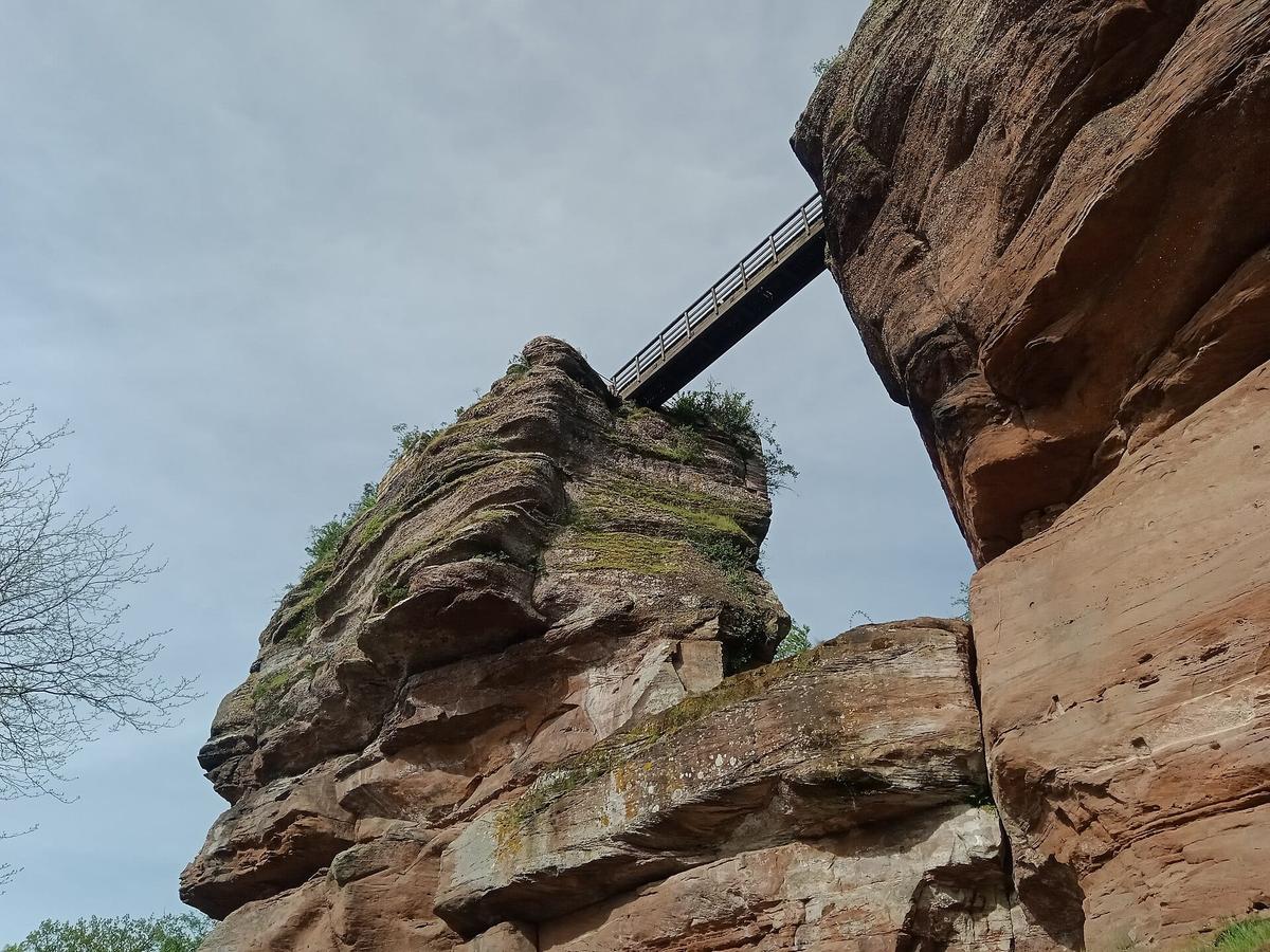
What strikes you on arrival is the shape of the site. The castle is not a single block but a series of buildings set on three separate rocks. The central rock is the largest, about 80 metres long. To the north, a second rock is about 65 metres long. To the south, the Markfels, about 25 metres long, is linked to the rest by a footbridge: the Devil's Bridge.
The castle is a listed historic monument (Mérimée record PA00084952). It is one of the easiest castle ruins to reach in Alsace: a road climbs right up to the foot of the rocks.
History of Haut-Barr in a few dates
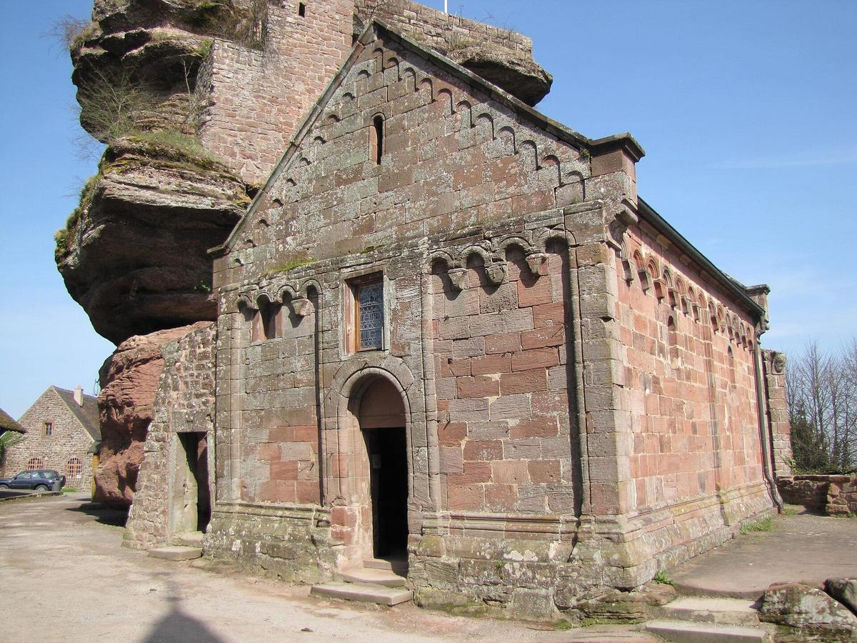
The castle first appears in written records in 1112, under the name Borre, then Borra. In 1168, the Bishop of Strasbourg bought the south rock, the Markfels, from Marmoutier Abbey to strengthen the defences. The castle chapel was built between 1170 and 1180.

In the 14th century, Bishop Johann von Lichtenberg carried out works and lived there. In 1525, during the German Peasants' War, the rebels tried to take the castle and failed.
From 1583 to 1586, Bishop Johann von Manderscheid modernised the site. The name Hohenbarr, the origin of today's name, appeared at the end of the 16th century.
In 1649 and 1650, at the end of the Thirty Years' War, French troops dismantled the castle. Only the chapel was spared; it was restored in 1668. A military post remained until 1772, after which the site was let to farmers.
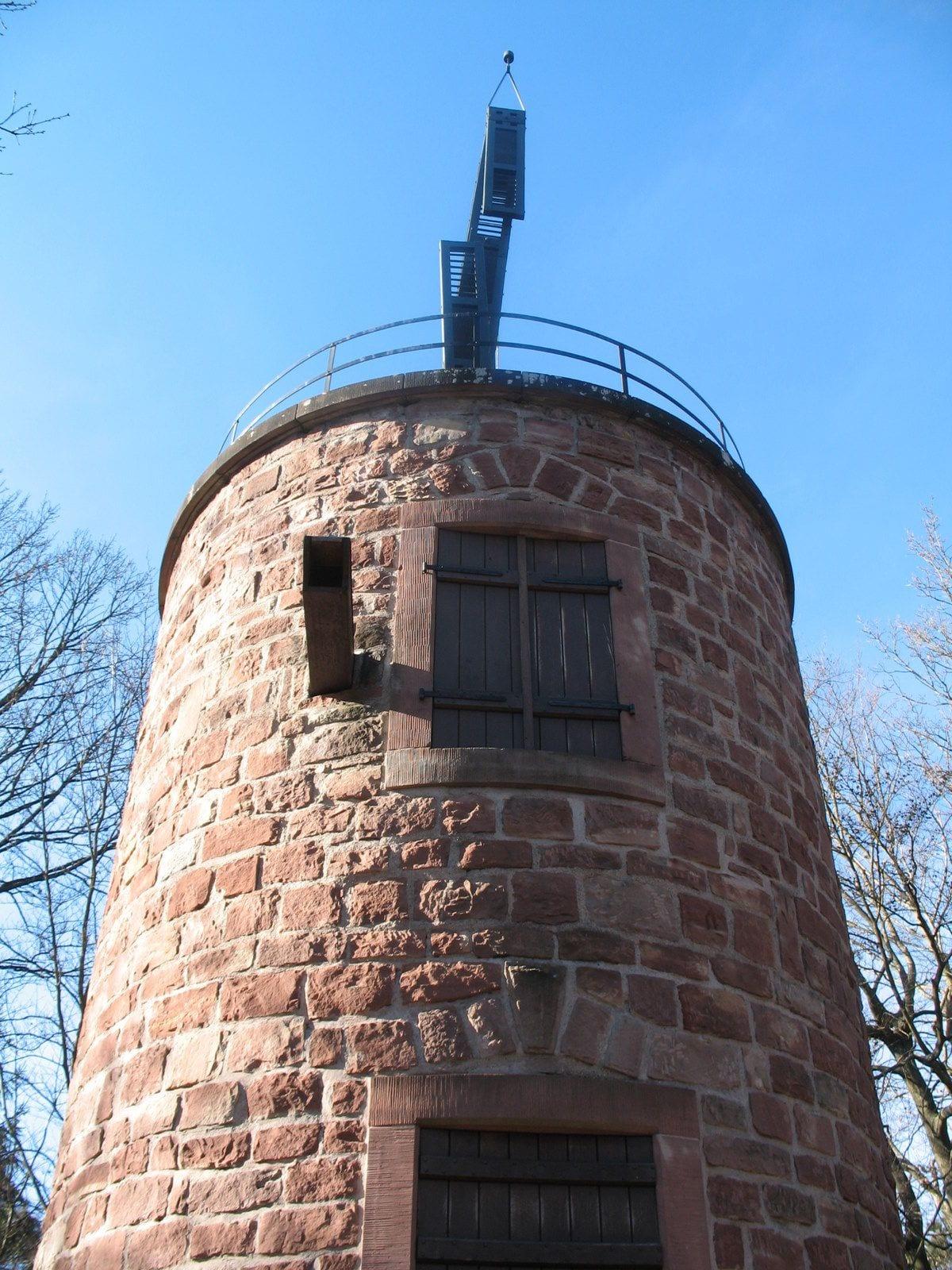
In 1798, a Chappe telegraph tower was built near the Devil's Bridge, on the Paris-Strasbourg line. A hotel-restaurant opened at the foot of the rocks in 1901. During the Second World War, the German army used the site as an observation post and built the "Villa Stuka" there.
Two stories
Why "the Eye of Alsace". According to the Alsace castles association, the nickname dates from 1415, at the time of the Council of Constance. Wikipedia gives the Latin form, Oculus Alsatiae, and explains it simply: from the top of the rocks, the view stretches in every direction.
The Brotherhood of the Horn. Bishop Johann von Manderscheid is said to have founded a drinking club here, the "Brotherhood of the Horn". Haut-Barr was then described as the "capitol of free drinkers" of the diocese. Signal horns have indeed been found on the site.
How much does it cost to visit Haut-Barr?
Nothing. Entry is free all year, according to the Vosges mountains tourist board. There is no ticket office: you park the car and climb onto the rocks.
What may cost money are the extras: the restaurant at the foot of the castle, and the guided tours or events organised from time to time by the Pays de Saverne tourist office and local associations. Ask the tourist office on +33 3 88 91 80 47.
Opening hours: when to visit Haut-Barr
The site is open access all year. No opening hours are published for the ruins themselves. In practice, come in daylight: the steps and footbridges are dangerous after dark.
The best time. Pick a clear day, after rain or with a north wind. That is when you can make out the spire of Strasbourg Cathedral, about forty kilometres away. In hazy weather, the plain disappears and the view loses much of its appeal.
In winter. The sandstone gets slippery with rain, frost or fallen leaves. The steps cut into the rock call for good shoes, especially from November to March.
At weekends. It is a very popular walking spot for local people. On sunny Sunday afternoons, the car park and the narrow steps get crowded. On a weekday or in the morning, you will have the rocks almost to yourself.
How long does it take to visit Haut-Barr?
Allow an hour to explore the three rocks, the chapel and the courtyard, taking time to enjoy the view. With a meal at the restaurant or a picnic, allow two hours.
If you walk up from Saverne on the waymarked trail, set aside half a day: the loop is 8.6 km and the Northern Vosges Regional Nature Park estimates it at 135 minutes of walking, not counting time at the castle.
What to see at Haut-Barr Castle
The north rock. This is the oldest part. It has the Romanesque keep, a cistern and the "Schnabel", a 16th-century polygonal bastion pointing towards the valley.

The central rock and the residence. The 12th-century Romanesque residence held the bishops' apartments on the upper floor. This rock, the largest, is where you spend most of your time.
The Devil's Bridge. A footbridge links the central rock to the Markfels, above the void. It is the best-known image of Haut-Barr. It is short, but impressive if you have no head for heights.
The Markfels and its shield wall. The south rock carries a shield wall built around 1168, nearly 2 metres thick. It protected the castle on the plateau side.
St Nicholas Chapel. Built in the 12th century, spared in 1649 and restored in 1668, it was given a new roof in 1880. Look at the holy water stoup: it bears a carved bearded head.
The Renaissance gateway. A large monumental gateway marks the entrance. Its coat of arms was chiselled off during the French Revolution.
The well tower. It houses a well of unknown depth. Another well dug in the neighbouring rock was abandoned at 25 metres.
The Chappe tower. A few steps from the castle, this tower was part of the Paris-Strasbourg optical telegraph line from 1798 to 1852. It was rebuilt in 1968 and houses an exhibition on the telegraph. It is open on a limited number of days, so check with the Saverne tourist office before counting on it.
Do you need to book a guided tour?
No, there is nothing to book for a self-guided visit. Guided tours run on certain dates, especially around the Chappe tower; the programme changes every year and is available from the Pays de Saverne tourist office.
If you are staying in Strasbourg and looking for an organised trip in the area, booking platforms mainly offer tours of Strasbourg and the Alsace Wine Route.
Partner links: if you book through these links, we earn a commission at no extra cost to you. Partner links · Learn more
Visiting with children
Children love Haut-Barr: there are steps in the rock, a footbridge over the void and nooks everywhere. But the Alsace castles association points out that you visit at your own risk and asks parents to keep a close eye on children.

A few simple rules:
- Do not let children run on the rocks or go near edges without railings.
- Do not allow climbing on the walls: the ruins are fragile and stones can come loose.
- Bring a baby carrier rather than a pushchair, which is useless on the steps.
- For older children, walking up from Saverne turns the visit into a real hike.
Accessibility
The site is not suitable for wheelchair users or people with limited mobility. The rocks are explored by steep steps, often without handrails, and narrow passages. From the car park, however, you can see the walls and part of the view without climbing.
How to get to Haut-Barr Castle
By car. From the centre of Saverne, follow the Route du Haut-Barr (D171): five minutes is enough. The road climbs to the foot of the rocks. Saverne has an exit on the A4 motorway, between Strasbourg and Metz; allow about 45 minutes from Strasbourg.
By train. Saverne station is served by TER regional trains from Strasbourg. There is no shuttle to the castle: from the station, walk up (see below) or take a taxi.
On foot from Saverne. This is the most enjoyable way to arrive. The tourist office reckons on about an hour and a half of walking. The Haut-Barr trail, waymarked by the Club Vosgien, starts from lock 16 bis in the town centre and largely follows the GR 53. The loop is 8.6 km with 277 metres of ascent. The Northern Vosges park recommends parking at the Rohan car park. On the way you pass the Unicorn Fountain, the emblem of Saverne.
Renting a car. To combine Haut-Barr with the castles of the Northern Vosges, a car is almost essential: the sites are scattered and poorly served by public transport.
What to combine on the same day
| Also worth seeing | Distance | Travel time |
|---|---|---|
| Lichtenberg Castle | 35 km | 40 min by car |
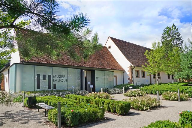
| Lalique Museum | 30 km | 35 min by car |
| Strasbourg Cathedral | 45 km | 45 min by car |
Approximate road distances and travel times.
To the north, the Château de Lichtenberg is the other great fortress of the Northern Vosges, restored and equipped for visitors. See also: Lichtenberg Castle On the way, the Lalique Museum in Wingen-sur-Moder presents the art of glass and crystal. See also: Lalique Museum Further north still, Fleckenstein is another castle carved into the sandstone. See also: Fleckenstein Castle
If you are coming from Strasbourg, Haut-Barr goes well with a morning at the cathedral, whose spire you can then look for from the rocks. See also: Strasbourg Cathedral To the south, Mont Sainte-Odile and Haut-Koenigsbourg complete a tour of the Alsace heights. See also: Mont Sainte-Odile, Haut-Koenigsbourg Castle, Alsace
Where to eat and stay
At the castle. A restaurant occupies the house at the entrance to the site, on the Route du Haut-Barr. It is called "Là-Haut". An article by food critic Gilles Pudlowski from August 2026 says it is open every day, serving Alsatian food (presskopf, tarte flambée, potato pancakes). Opening days may change in winter: call before you go up if you plan to have lunch there.
In Saverne. The town, five minutes away, has more choice: winstubs, brasseries and terraces along the Marne-Rhine Canal. The Château des Rohan, in town, houses the Saverne museums.
Where to stay. Saverne is the easiest base for exploring Haut-Barr, the Northern Vosges and the plain. Strasbourg is the other option if you prefer a day trip.
FAQ
Do you have to pay to visit Haut-Barr Castle?
No. The site is free and open access all year, with no ticket or ticket office.
Can you drive up to Haut-Barr?
Yes. The Route du Haut-Barr (D171) climbs from Saverne to the foot of the rocks in about five minutes.
Why is Haut-Barr called the Eye of Alsace?
Because from its rocks the view takes in the whole Alsace plain as far as Strasbourg, and the Lorraine plateau. The nickname goes back to the Middle Ages.
Can you really see Strasbourg Cathedral from Haut-Barr?
Yes, on a clear day. Come when visibility is good, in the morning or after rain.
How long is the hike from Saverne?
The Haut-Barr trail is 8.6 km and takes about 135 minutes of walking, starting from lock 16 bis.
Is the visit suitable for young children?
Yes, as long as you watch them closely: the site has sheer drops and steps without railings.
Practical information
Official ticket-office prices 2026
Free admission
Address
Route du Haut-Barr (D171), 67700 Saverne, France
Directions · Phone+33 3 88 91 80 47
On site and nearby
- Nearest shops and pharmacy: Saverne, 3 km away Straight-line distance, based on OpenStreetMap.
- Emergencies: 112 (all emergencies, free from any phone), 15 (SAMU, medical emergency)
Around the site, on Google Maps
With children
Family days out nearby: Saint-Louis-Arzviller Boat Lift (9 km), Lalique Museum (22 km), Lichtenberg Castle (24 km)
Swimming pools and play areas nearby, on Google Maps
Facts checked on 12 November 2026. Sources: vosges-mountains.com, chateauxfortsalsace.com, fr.wikipedia.org, en.wikipedia.org, de.wikipedia.org, geotrek.parc-vosges-nord.fr
Map
In the same region
- La Ferme aux Rennes (Reindeer Farm)from €7Free under 3