Garabit Viaduct: planning your visit
Garabit Viaduct at a glance
- Admission
- Free
- Time needed
- 30 minutes for the viewpoints, half a day with a walk or an outing on the lake
- Where
- Ruynes-en-Margeride
Facts checked on 11 November 2026. Full opening hours, reduced prices and access
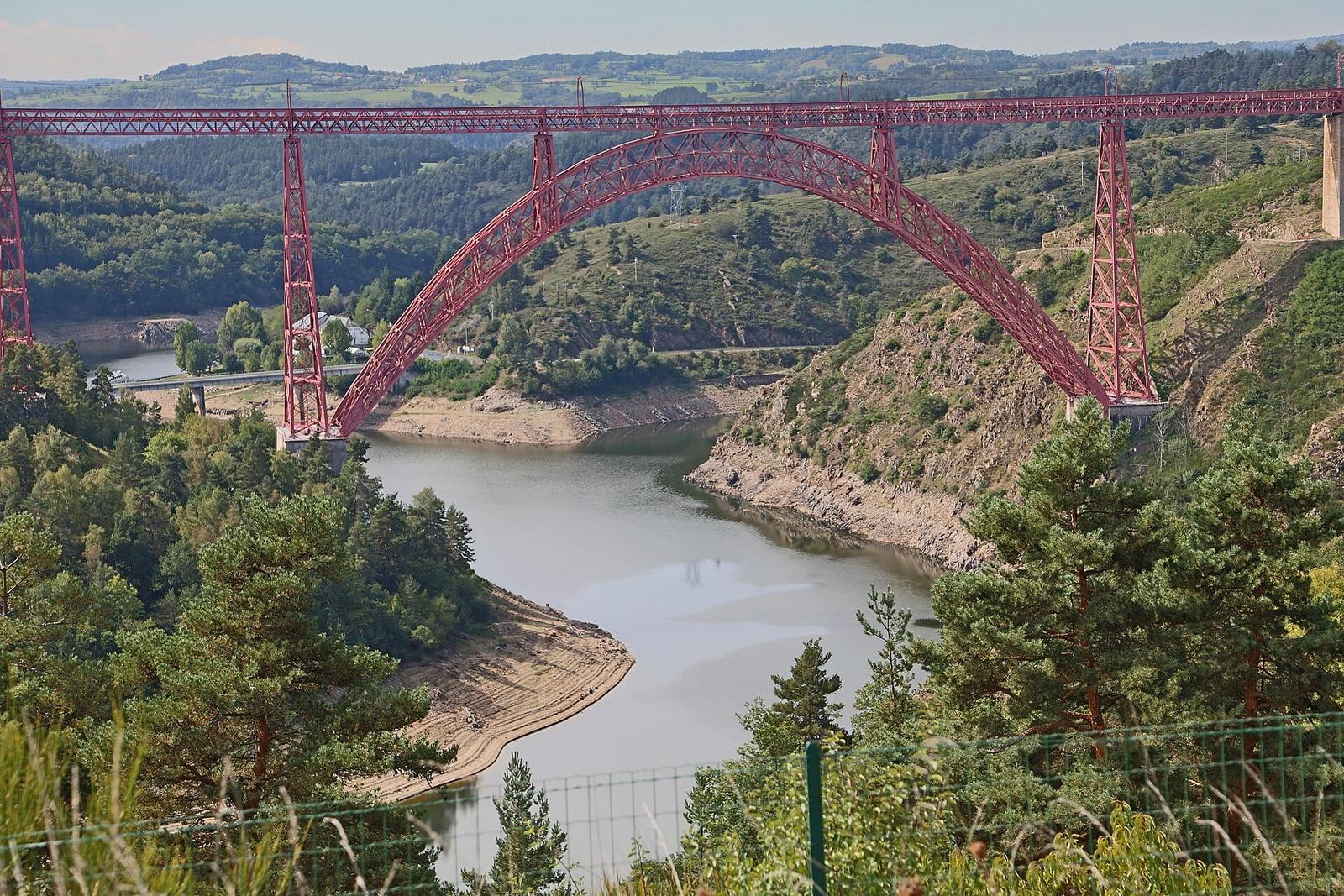

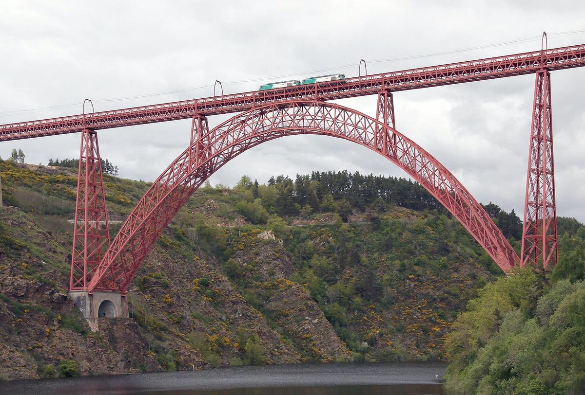
A red iron arch spanning 165 m, more than 120 m above the Truyère gorge: the Garabit Viaduct, completed by Gustave Eiffel's company in 1884, is visible from the A75 motorway, but it deserves more than a glance through the windscreen. Here is where to see it from, when it is lit up, how to pass beneath it by boat or cross it by train, and our tips for planning the stop.
Garabit Viaduct at a glance
- Where: in the Cantal, between Saint-Flour and Ruynes-en-Margeride, above the Garabit-Grandval lake, about fifteen minutes south of Saint-Flour on the A75.
- Price: free. You view the viaduct from outside; there is no ticket and no inside visit.
- Open: all year, day and night.
- Illuminations: every evening from mid-March to mid-November, then at weekends (18:30 – 21:00) until 14 March 2027.
- Time needed: 30 minutes for the viewpoints, half a day with a walk or an outing on the lake.
- Best for: engineering and railway fans, families driving south, lake and fishing lovers.
Why stop at the Garabit Viaduct
In the 1870s, the Compagnie du Midi wanted to extend the railway south and link Paris to Béziers across the Massif Central. The deep, narrow Truyère gorge was thought impossible to cross. A young engineer, Léon Boyer (1851-1886), proposed a direct route across the plateaus and a crossing about 120 m high. Gustave Eiffel's company won the contract without a tender: the State chose it because it had just built a bridge of the same type in Porto, the Maria Pia Bridge.
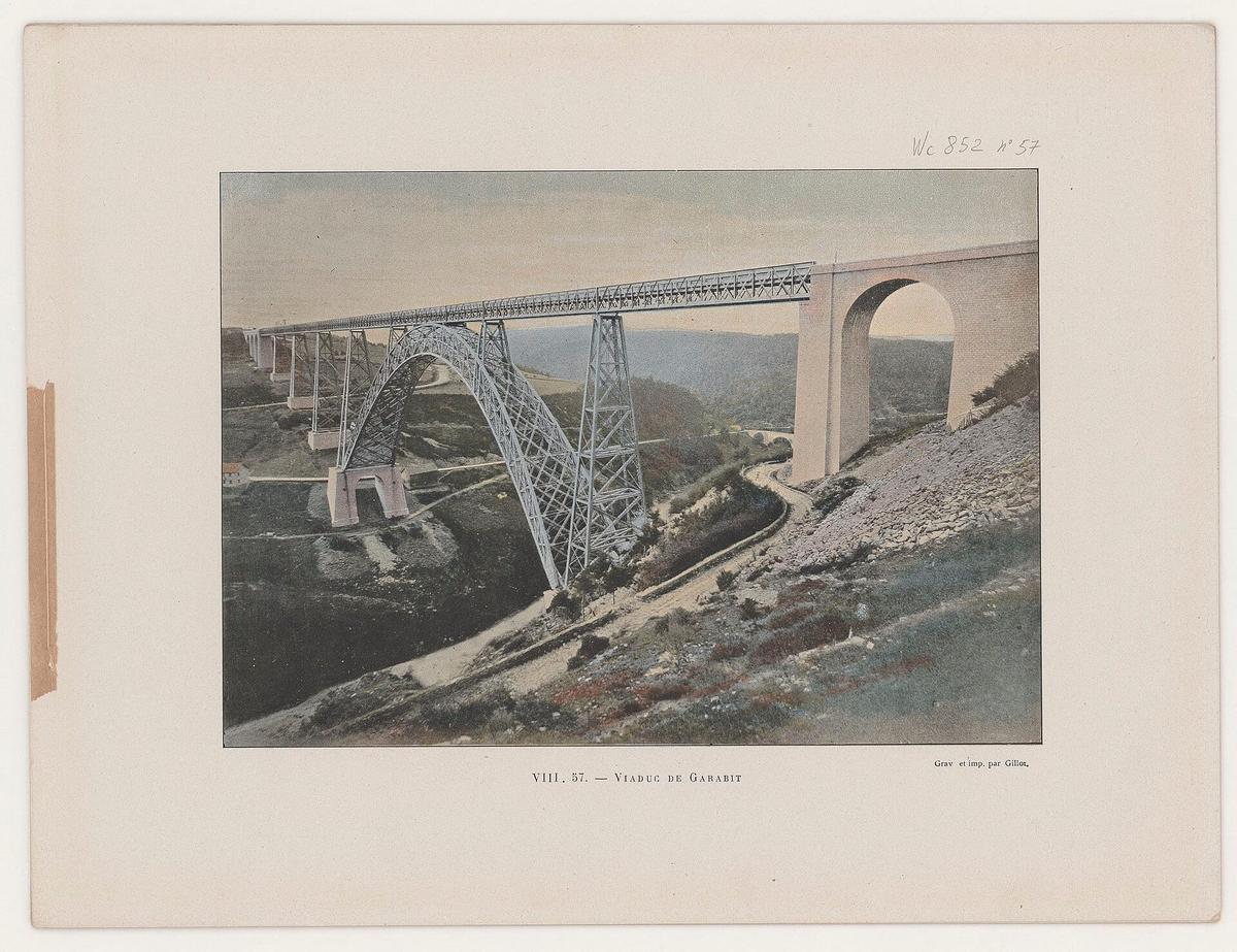

Work lasted from 1880 to 1884. The engineer Maurice Koechlin, who later designed the Eiffel Tower, did the structural calculations. The line opened in 1888. Léon Boyer never saw it: he died in Panama in 1886.
The figures give a sense of the scale, according to the regional tourist board and Wikipedia:
- Length: 564.69 m.
- Height: 122.2 m above the river as originally built.
- Arch span: 165 m, with a height of 52 m.
- Iron: 3587 tonnes and 678,768 rivets.
- Cost: 3,100,000 francs at the time.
When it opened, Garabit was the highest viaduct in the world, and its arch was the longest until the Dom Luís I Bridge in Porto was completed in 1886.
A story about its strength. During load tests, the deck sagged by only about 8 mm under the weight of the trains, exactly as Eiffel had calculated. A train is said to have crossed it at 50 km/h from the start, with no noticeable vibration.
A viaduct that "shrank". In 1959, the Grandval dam flooded the valley and created a lake 28 km long. Since then, the viaduct stands only about 95 m above the water. The landscape has changed: the wild gorge of 1884 is now a lake used for fishing and boating.
The viaduct was listed as a historic monument in 1965 and given the higher "classé" status in 2017. Since late 2017, it has been part of a UNESCO World Heritage bid with the Viaur Viaduct, alongside other great iron arch viaducts in Germany, Italy and Portugal.
Best viewpoints of the Garabit Viaduct
The Pays de Saint-Flour tourist office recommends four spots:
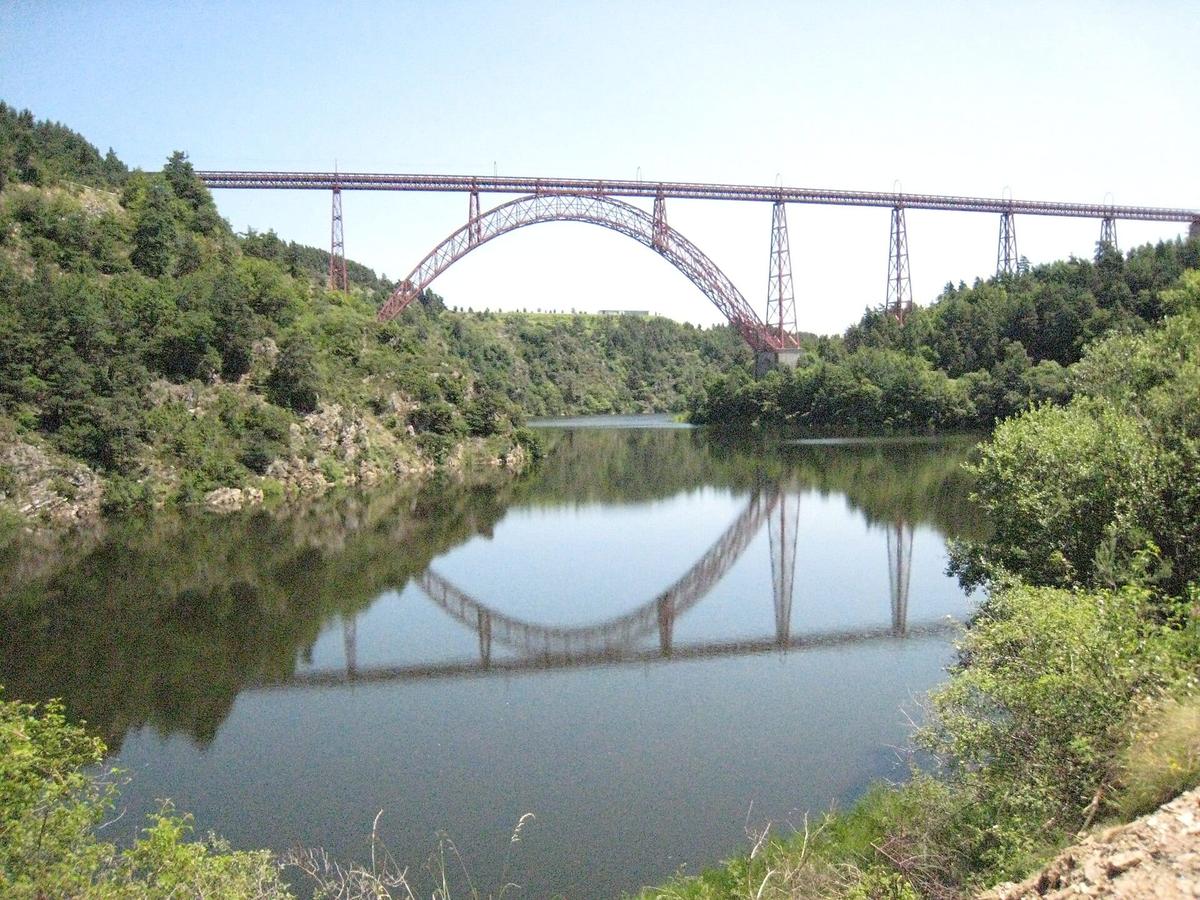

The Garabit road bridge (D909). This is the classic viewpoint. The road bridge crosses the Truyère right next to the viaduct, so you see it side on, with the whole arch and the lake below.
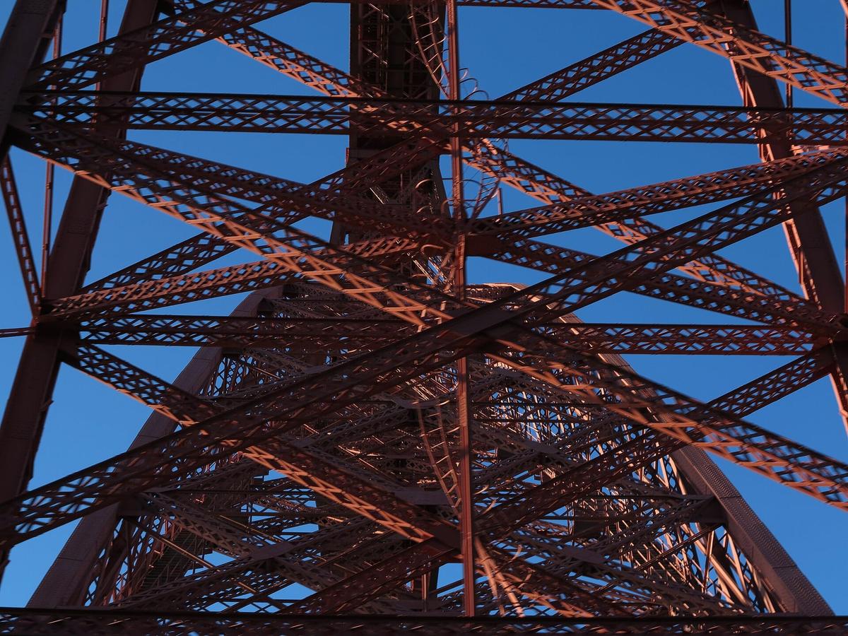
The D13 towards Ruynes-en-Margeride. From the road bridge, this small road climbs to the village and passes very close to the structure. This is where you best get a sense of the size of the piers and the web of girders.
The Garabit rest area on the A75. If you are on the motorway, the rest area a few kilometres south of Saint-Flour has a clear view. It is also home to the Maison du Cantal, with an exhibition and information in French and English.
The Cirque de Mallet viewpoint. A little further on, on the Truyère gorge scenic route, this viewpoint looks over the whole Garabit-Grandval lake. The viaduct appears in the distance, set in its landscape.
At the foot of the viaduct, a permanent open-air exhibition, "Le fabuleux destin du Viaduc de Garabit", tells the story of its construction.
Our tip: for photos, come in the late afternoon. The setting sun warms the red of the metal, then the lights take over as night falls.
Garabit Viaduct illuminations: what time is it lit up?
The viaduct has been lit up since 2001. The schedule published by the Pays de Saint-Flour tourist office:
- 15 March to 31 May: every evening, from nightfall until 22:00.
- 1 June to 31 August: every evening, from nightfall until 1:00.
- 14 July and 15 August: all night.
- 1 September to 11 November: every evening, from nightfall until 22:00.
- 12 November to 14 March: 18:30 – 21:00, on Fridays, Saturdays and Sundays only, and every evening during the Christmas holidays.
- Christmas Eve and New Year's Eve: all night.
In winter, night falls early: on a Friday or Saturday in December, you can see the viaduct lit up from 6.30 pm as you drive past on the motorway.
Is the Garabit Viaduct free?
Yes. The viaduct is not a paying site: the viewpoints, the open-air exhibition and the footpaths are all free. The only costs are activities on the lake (boat hire, fishing) and, if you wish, a train ticket to cross it.
Can you walk across the viaduct? No. It is a working single-track railway bridge with no footway. To cross it, you have to take the train.
Guided tours of the viaduct
The tourist office runs guided tours of the viaduct in July and August, in French. Dates are published in its summer events calendar. Groups can book a tour all year round through the tourist office's group service in Saint-Flour.

Partner links: if you book through these links, we earn a commission at no extra cost to you. Partner links · Learn more
Boat trips under the Garabit Viaduct in 2026
Passing under the arch by boat is one of the best ways to see the structure. For 2026, the tourist office does not list any regular commentated cruise on the Truyère. Instead, it points to the motorboating centre at the foot of the viaduct, in the commune of Val d'Arcomie. It offers:
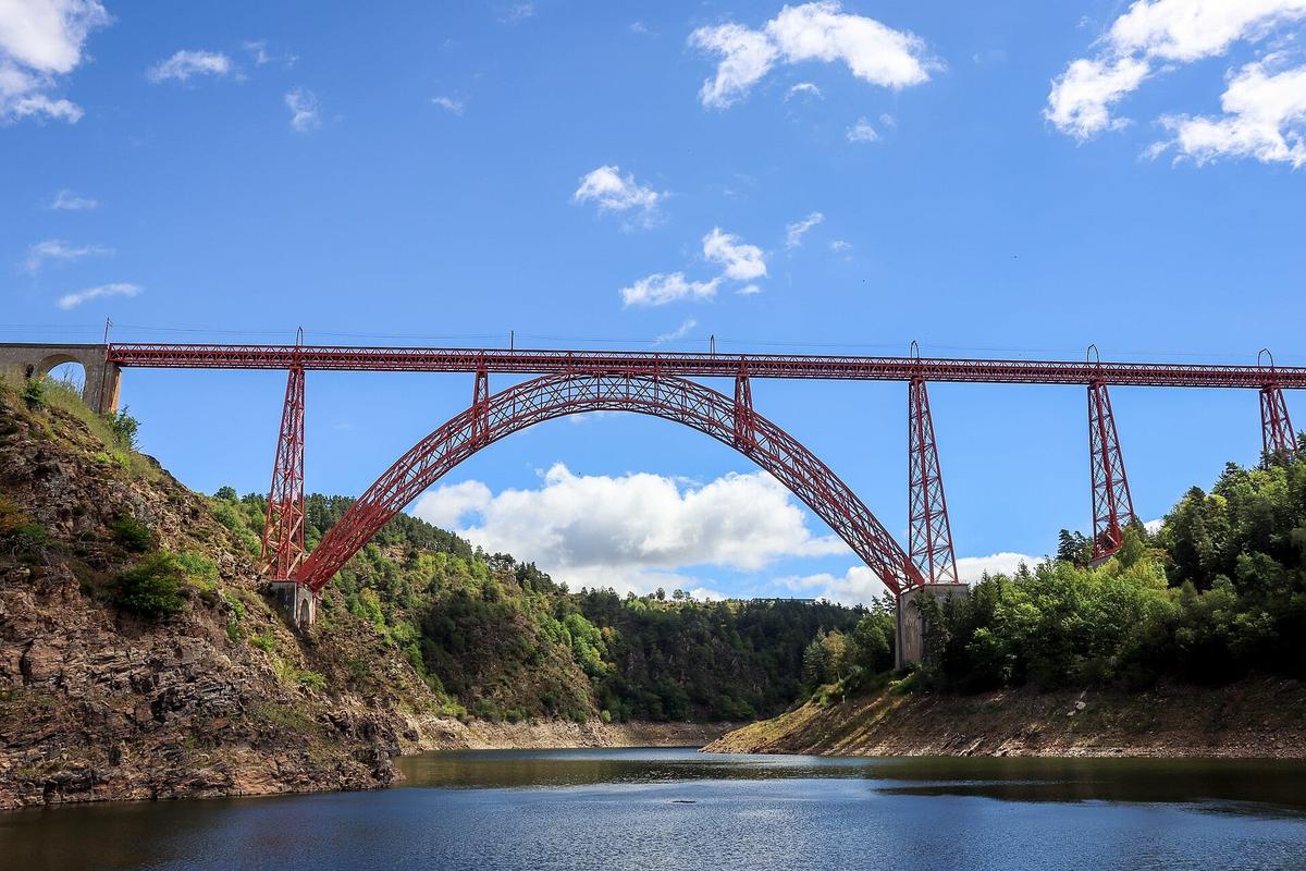

- boat hire without a licence and with a licence, to sail under the viaduct and up the Truyère towards Chaliers;
- boat trips and fishing outings;
- water-skiing, wakeboarding, towed inflatables, paddleboards and pedalos.
Prices and season dates are not published on the centre's website: book online or call before you come, especially outside July and August.
Other activities on the lake. The Garabit-Grandval and Lanau lakes are good for canoeing, sailing, rowing and rowing-boat hire. You can swim at Mallet beach, which has lifeguards in summer. The lake is also known for pike and other predatory fish.
Crossing the viaduct by train
The viaduct still carries the Béziers to Neussargues line, electrified in 1932. Trains cross it slowly: speed is limited to 40 km/h on the bridge. In 2009, cracks in a foundation led to a month-long closure and a temporary limit of 10 km/h.
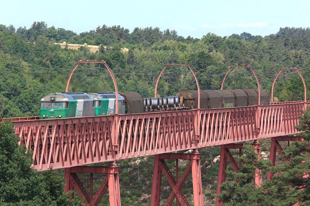

The ride is a small adventure: you see the lake below the windows, with nothing that seems to hold the train up. Before planning the trip, check train times on the SNCF website, as services on this mountain line are limited.
How long to spend at the viaduct
Allow 30 minutes for the viewpoints, half a day with a walk or an outing on the lake. For a break on a road trip, the A75 rest area and the road bridge are enough. For half a day, add the Chaliers trail, a 5 km loop of about 1 hour 45 minutes to the village of Chaliers and its small open-air museum, or an hour on the lake by boat.
Visiting with children
Children love the viaduct for its size and for the trains. The tourist office suggests family outings around Garabit: swimming with lifeguards at Mallet beach in summer, pedalos and paddleboards at the water sports centre, a walk to Chaliers. The open-air exhibition at the foot of the viaduct tells the story of its construction. In the evening, the illuminations usually make an impression.

The viaduct on screen
Garabit has been used as a film location several times. Henri-Georges Clouzot shot L'Enfer there, with Romy Schneider and Serge Reggiani, a film that was never finished. It also appears in Costa-Gavras's Shock Troops (Un homme de trop) and in The Cassandra Crossing (1976), where it plays a condemned bridge. It features in the opening credits of Camping 2. Finally, the viaduct was printed on the front of the 200-franc banknote bearing Gustave Eiffel's portrait, issued in 1996.
Between 1992 and 1998, it was entirely repainted in a red known as "Gauguin".
How to get to the Garabit Viaduct
By car. The viaduct is right next to the A75, the "Méridienne" motorway linking Clermont-Ferrand to Béziers, which is toll-free on this stretch. Leave at the Saint-Flour or Ruynes-en-Margeride exit, then follow the D909 to the Garabit road bridge. Allow about 15 minutes from Saint-Flour and 1 hour 15 minutes from Clermont-Ferrand. On the motorway, the Garabit rest area lets you stop without leaving it.
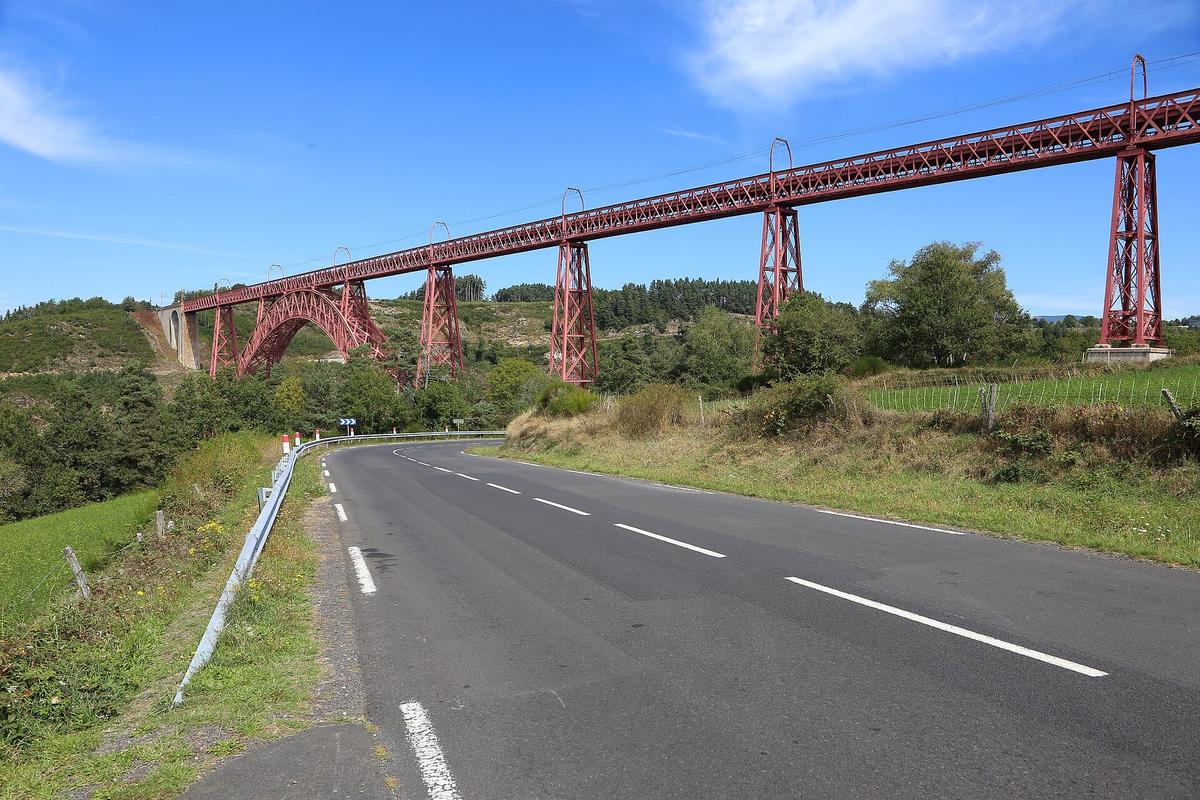

By train. Trains cross the viaduct, but there is no station at its foot. To see it from below, you need a car.
Renting a car. Clermont-Ferrand, with its railway station and airport, is the most convenient starting point for driving down to the Cantal and the Margeride.
What to combine with the viaduct
| Also worth seeing | Distance | Travel time |
|---|---|---|
| Salers | 85 km | 90 min by car |
| Lac Pavin | 110 km | 80 min by car |
Approximate road distances and travel times.
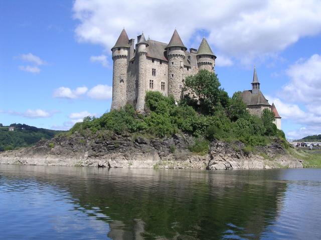
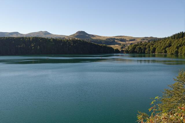
Saint-Flour, a quarter of an hour away, sits on a basalt lava flow with its cathedral built of volcanic stone. Further west, beyond the Cantal mountains, Salers and its dark stone houses make a fine stop. See also: Salers The Château d'Anjony, close to Salers, is one of the best preserved castles in Upper Auvergne. See also: Château d'Anjony To the north, Lac Pavin shows another side of the volcanic landscape. See also: Lac Pavin, Le Puy Cathedral, La Chaise-Dieu Abbey, Château de Val, Auvergne
Where to eat and stay
According to the tourist office, two places look straight onto the site: the Le Beau Site hotel and restaurant, whose dining room has a view of the viaduct, and L'Escale restaurant, by the water at Garabit.
To stay, Saint-Flour is the most convenient base, with its upper town, hotels and B&Bs. By the lake, around Garabit and Mallet, there is also accommodation for a summer stay in the countryside.
Places to stay near Saint-Flour
FAQ
Is the Garabit Viaduct free to visit?
Yes. You can view it for free from the road, the A75 rest area and the viewpoints.
What time is the Garabit Viaduct lit up?
From mid-March to mid-November, every evening from nightfall until 22:00, or 1:00 in summer. From mid-November to mid-March, 18:30 – 21:00 on Fridays, Saturdays and Sundays, and every evening during the Christmas holidays.
Can you take a boat trip under the viaduct?
No regular commentated cruise has been announced for 2026. The motorboating centre at the foot of the viaduct hires out licence-free boats and runs trips on the lake.
Who built the Garabit Viaduct?
It was designed by the engineer Léon Boyer and built by Gustave Eiffel's company between 1880 and 1884, with Maurice Koechlin doing the calculations.
Is the viaduct still in use?
Yes, it carries the single-track Béziers to Neussargues railway line, with a speed limit on the bridge.
Where can I see the viaduct from the motorway?
From the Garabit rest area on the A75, a few kilometres south of Saint-Flour, which is also home to the Maison du Cantal.
Practical information
Official ticket-office prices 2026
Free admission
Address
Viaduc de Garabit, D909, 15320 Ruynes-en-Margeride, France
Directions
On site and nearby
- On site: Food and drink
- Nearest shops and pharmacy: Ruynes-en-Margeride, 5 km away Straight-line distance, based on OpenStreetMap.
- Emergencies: 112 (all emergencies, free from any phone), 15 (SAMU, medical emergency)
Around the site, on Google Maps
With children
Family days out nearby: Château de Chavaniac-Lafayette (38 km), Château de la Rochelambert (51 km), Polignac Fortress (55 km)
Swimming pools and play areas nearby, on Google Maps
Facts checked on 11 November 2026. Sources: pays-saint-flour.fr, auvergnerhonealpes-tourisme.com, fr.wikipedia.org, en.wikipedia.org
Map
In the same region